hiking three lakes
cerces - rond - grand ban
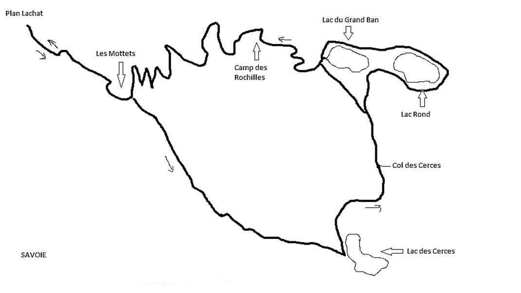
This hike begins at Plan Lachat, parking on the road of the Col du Galibier, 8 kilometers before the summit and 9.5 kilometers after the village of Valloire.
The altitude of the starting point in the Plan Lachat is 1962 meters. It continues with the Mottets to 2137 meters, continuously Lake Cerces to 2405 meters, then passes through the Col Cerces to 2574 meters and after that Col descends to the two lakes to 2450 meters altitude.
Only after the passage of two lakes, the descent is constant by carriage road to Plan Lachat.
A total vertical drop of 612 meters.
