Hiking col de la croix de Fer
at Glacier de Saint-Sorlin
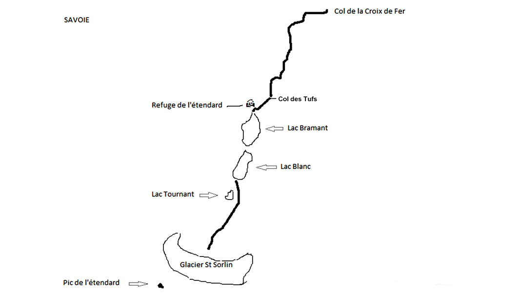
The hiking course starts from the Col de la Croix de Fer.
The Col de la Croix de Fer is available Savoy from Saint-Jean-de-Maurienne via Saint-Jean-d'Arve or St-Etienne-de-Cuisne via the Col du Glandon, but also the Isère by Allemont / Le Rivier d'Allemont.
This route starts at 2064 meters the Col de la Croix de Fer, continues until Col Tufs to 2520 meters above sea level to slightly down at the lake Bramant to 2430 meters. The ride continues with the White Lake to 2473 meters and then take the direction of St Sorlin glacier where you will be at the foot about 2650 meters above sea level.
A total vertical drop of 766 meters for this hike if you take into account the slight descent of the col Tuffs of the Lake Bramant with his ascent to return.
